

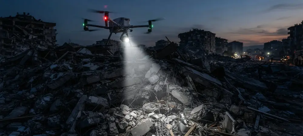
Priority scoring for rescue zones integrates device counts and movement trends to guide the deployment of limited emergency resources. In the immediate aftermath of a structural failure or earthquake, the race against time defines the survival probability of those trapped beneath the wreckage. Historically, the “golden hour” has been dominated by acoustic sensors and search dogs, but modern urban landscapes now present a unique digital opportunity. As individuals carry smartphones and wearable technology, the air becomes saturated with radio-frequency markers that can pierce through obstacles where human sight fails. Traditional optical cameras and thermal imagers are often rendered useless by the thick plumes of dust and smoke common in collapse zones. Consequently, emergency response agencies are increasingly looking toward autonomous systems capable of harvesting these invisible data streams. By utilizing unmanned aerial vehicles to capture the passive probe request frames emitted by consumer electronics, rescuers can now visualize the human presence hidden deep within layers of concrete and steel.
Overcoming Signal Interference in Debris
Addressing the Volatility of Radio Signals
The primary obstacle to using Wi-Fi for location tracking in a disaster zone is the unpredictable nature of signal strength, known as the Received Signal Strength Indicator (RSSI). In an open space, signals weaken predictably with distance, following an inverse-square law that allows for relatively straightforward distance estimation. However, the chaotic environment of a structural collapse introduces a phenomenon called multipath propagation. Radio waves do not travel in a clean, straight line; instead, they bounce off metallic reinforcements, reflect from glass surfaces, and are heavily attenuated by thick, moisture-laden concrete walls. This environmental complexity creates massive fluctuations in the data collected by airborne sensors. A survivor who is buried only a few meters deep under heavy debris might produce a signal that appears much weaker and further away than it actually is. Without a sophisticated method to filter these distortions, the resulting location data would lead rescue teams toward empty ruins.
Beyond physical obstructions, the electronic noise inherent in urban environments further complicates the task of isolating life-saving signals. Interference from surrounding electrical infrastructure or overlapping network transmissions can mask the faint probe requests sent by a survivor’s device. These probe requests are the standard packets smartphones send out while searching for known Wi-Fi networks, and they represent a consistent heartbeat that drones can monitor. The challenge lies in the fact that the signals are not constant; they are bursty and subject to rapid fading as the drone changes its orientation or position relative to the survivor. Engineers have long struggled to develop a mathematical framework that can distinguish between these environmental artifacts and the actual physical location of the transmitter. Addressing this volatility is not merely a technical preference but an operational necessity, as search and rescue missions cannot afford the time required to investigate false positives in high-noise environments.
Implementing Strategic Flight Patterns
To solve the problem of fluctuating data, researchers designed a specific flight strategy called Boustrophedon scanning, which provides a structured way to gather signal information across a wide area. In this approach, drones fly in a back-and-forth serpentine pattern, much like a tractor systematically plowing a field or a lawnmower covering a garden. This movement is executed at a consistent speed and altitude, which is critical for the subsequent mathematical analysis. By maintaining a steady trajectory, the unmanned aerial vehicle creates a predictable relationship between its own coordinates and the signals it intercepts from below. This systematic coverage ensures that no part of the disaster site is overlooked, and it allows the system to collect multiple data points for every potential survivor. Rather than relying on a single snapshot of signal strength, the drone gathers a continuous stream of information as it approaches, passes over, and moves away from each individual Wi-Fi-enabled device. The deliberate nature of this serpentine movement ensures that as a drone passes over a stationary device, the recorded signal strength follows a recognizable bell-shaped curve. This pattern, known as the RSSI envelope, is the key to overcoming the noise of the environment. The peak of this curve represents the point of closest approach, where the drone is physically nearest to the person trapped beneath the rubble. By analyzing the shape and peak of these curves across multiple flight passes, the central processing system can identify the most likely location of survivors despite the surrounding interference. This method effectively transforms the drone’s movement into a powerful spatial filter. It allows the system to ignore momentary signal spikes caused by reflections and instead focus on the underlying trend of the radio-frequency energy. This approach is significantly more robust than traditional trilateration, as it leverages the entire history of the flight path to reach a more accurate conclusion.
Data Processing for Precision and Awareness
Advanced Denoising through Mathematical Decomposition
Once the drones collect raw signal data during their flight, the system uses a sophisticated process called Singular Value Decomposition (SVD) to clean the information and remove environmental artifacts. The raw measurements are first organized into a specialized mathematical structure known as a Hankel matrix, which captures the temporal and spatial relationships between each intercepted packet. Through SVD, the system can mathematically isolate the primary signal subspace, which contains the most relevant data regarding the survivor’s location. By discarding the components associated with noise and interference, the algorithm reconstructs a smoothed version of the signal curve that more accurately reflects physical distance. This mathematical refinement is essential for turning an unreliable data stream into a precise navigation tool.
One of the most significant advantages of this denoising method is that it does not require a prior map of the disaster site or a complex model of the surrounding materials. In the immediate aftermath of a collapse, rescuers rarely have access to updated architectural plans or information about the specific types of rubble they are navigating. The SVD-based approach is particularly effective because it extracts the necessary location data purely from the patterns gathered during the flight itself, making it highly adaptable to any environment. This model-free characteristic means the system can be deployed instantly in diverse settings, from collapsed high-rise apartments to sprawling industrial complexes. Furthermore, the computational efficiency of this mathematical decomposition allows for near real-time processing of data. As the drones continue their sweep, the system provides updated estimates of survivor locations, allowing the rescue mission to adapt as more information becomes available, ensuring that no time is wasted.
Defining Regional Priorities for Rescue Teams
The system goes beyond pinpointing coordinates by providing regional situational awareness for rescue commanders, which is vital for managing large-scale operations. Instead of presenting a confusing cloud of individual data points, the disaster area is divided into specific zones or sectors. This partitioning allows the UAV swarm to aggregate data at a higher level, identifying clusters of human activity that might represent groups of survivors. For each zone, the system tracks whether the detected signals are stationary or showing signs of movement over multiple scan cycles. This high-level view is crucial for commanders who must make difficult decisions about where to commit their personnel and equipment. By visualizing the disaster site as a heat map of human presence and activity, the technology provides a clear picture of the overall situation. This allows for a more organized response, ensuring that the most heavily populated or active areas are addressed first, while maintaining a watch over the entire area. Movement is a strong indicator of vitality and survival, and the system uses this data to prioritize specific zones for immediate intervention. Because the drones perform multiple passes over the same area, they can detect if a device’s position has shifted significantly between scans. If a signal shows displacement beyond a certain threshold, it is flagged as a moving device, suggesting that the person carrying it is conscious and capable of movement. This displacement data is integrated into a priority score for each zone, helping commanders decide exactly where to deploy their limited resources for the greatest potential impact. This method recognizes that a stationary signal could belong to an abandoned device or an unconscious individual, whereas movement signifies a high probability of a viable rescue. By focusing on these indicators, the system helps minimize the risk of rescuers spending hours in low-probability areas while survivors in other locations are actively trying to signal for help.
Establishing New Standards for Emergency Response
The development of Wi-Fi-based drone tracking shifted the paradigm of how emergency responders located people in the dark, through smoke, or under ruins. By turning every smartphone into a beacon and every drone into a sophisticated sensor, the system provided a digital sense that operated where human sight failed. Practical implementation of this technology required seamless coordination between software developers and first responders to ensure that the data outputs were both intuitive and actionable during the chaos of a real mission. Moving forward, the focus transitioned toward integrating these autonomous swarms into the standard gear of urban search and rescue units. Future considerations emphasized the need for international standards in drone communication to allow different agencies to cooperate during multi-national disaster relief efforts. Ultimately, the ability to map human presence through rubble through radio-frequency analysis became a fundamental tool, significantly reducing the time required to find survivors.