

Traditional ground transportation in mountainous regions often turns short linear distances into multi-hour journeys due to winding and inefficient roads. This geographical friction has long stifled the economic potential of remote areas, trapping communities in a cycle of limited access and high logistical costs. However, the rise of the low-altitude economy—comprising aerial activities below 1,000 meters—is beginning to rewrite these physical constraints. By deploying autonomous drones for high-speed delivery, logistics providers can bypass the serpentine paths of the earth for the direct efficiency of the sky. Yet, the leap from experimental flight to a scalable, green infrastructure requires more than just better propellers. It necessitates a revolutionary shift in how these machines communicate and consume energy. The ongoing integration of 6G wireless architectures represents this missing link, offering a framework where connectivity and environmental stewardship are no longer at odds. This evolution is particularly visible in regions like Eastern Guizhou, where extreme topography creates unique radio shadows that serve as the ultimate proving ground for next-generation telecommunications and sustainable aerial logistics.
The Mechanics of Sustainable Connectivity
Implementing the Ternary Coupling Model: Linking Communication and Energy
A breakthrough in the pursuit of sustainable aerial logistics is the development of the communication–energy–carbon ternary coupling model. This sophisticated framework recognizes that a drone’s communication performance, its battery drain, and its total carbon footprint are inextricably linked rather than separate variables. In earlier systems, flight path planners prioritized either the fastest route or the strongest signal strength, often overlooking how fluctuating signal quality forced drones to ramp up transmission power. This increased power demand accelerated battery depletion and forced more frequent charging cycles, which in turn relied on regional power grids with varying carbon intensities. By utilizing 6G to integrate these factors into a single optimization algorithm, operators can now quantify the environmental cost of every decibel of signal gain. This allows for a holistic approach to flight management where drones are programmed to navigate the sky in a way that balances the need for high-speed data with the imperative to minimize the overall energy burden.
Building on this integrated approach, the ternary model allows for real-time adjustments based on the current state of the local energy ecosystem. For instance, if a drone is operating in an area where the power grid is currently heavy on fossil fuel consumption, the 6G network can prioritize flight paths that require the least transmission energy, even if it results in slightly lower data throughput. Conversely, when renewable energy production is at its peak, the system might allow for higher-bandwidth activities. This level of granular control turns the drone into a smart node within a wider green energy network. The ability to predict carbon emissions based on communication efficiency provides a measurable metric for sustainability that was previously impossible to achieve. As a result, the low-altitude economy becomes a data-driven enterprise where environmental responsibility is built into the software architecture, ensuring that every delivery mission contributes to a broader reduction in the logistical carbon footprint across rugged landscapes.
Harnessing the 0.3-THz Spectrum: High Bandwidth with Passive Efficiency
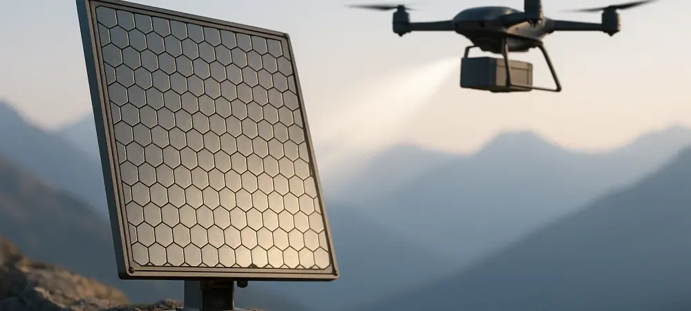
To support the intense data requirements of autonomous drone fleets, researchers are turning to the 0.3-terahertz (THz) frequency band. This portion of the spectrum offers massive bandwidth and near-zero latency, far exceeding the capabilities of 5G. However, these high-frequency waves behave more like light than traditional radio waves, meaning they are easily absorbed by atmospheric moisture and blocked by physical obstacles like mountains or buildings. To solve this, the integration of Reconfigurable Intelligent Surfaces (RIS) has become essential. These are programmable metasurfaces that can be mounted on ridges or rooftops to electronically steer signal beams toward moving drones. Unlike traditional active relays that require significant power to amplify and retransmit signals, RIS acts as a collection of passive reflectors. By manipulating the phase of the incident waves, these surfaces can redirect connectivity into deep valleys and around cliffs without adding substantial energy overhead to the network infrastructure. Complementing this spectrum advancement is the emergence of Integrated Sensing and Communication (ISAC), which serves as a primary pillar of the 6G evolution. In conventional drone setups, the aircraft must carry separate hardware for radar sensing and data communication, which increases weight and drains battery life. 6G solves this by using a single waveform to perform both functions simultaneously. The radio signals sent to the drone for communication are also used to sense the surrounding environment, detecting obstacles, other aircraft, and changes in topography with high precision. This hardware consolidation reduces the dead weight of the drone, which directly translates to lower propulsion energy requirements. In the complex three-dimensional environments of mountainous terrain, such precision is vital for flight safety and energy conservation. By streamlining the physical and digital load of the aircraft, ISAC ensures that the drone can navigate narrow canyons and avoid obstacles while maintaining a high-quality link to the ground station.
Geographic Integration and Empirical Results
The Space–Air–Ground Integrated Network: Seamless Multi-Layered Coverage
The challenge of maintaining connectivity in isolated regions is addressed through the Space–Air–Ground Integrated Network (SAGIN) architecture. This three-layered strategy ensures that no valley or peak remains a dead zone for aerial logistics. The ground layer consists of high-capacity terrestrial base stations located in urban hubs and along major transport corridors. When drones move beyond the range of these towers, the air layer takes over, utilizing aerial nodes such as tethered balloons or other drones to extend signal coverage into deep terrain. Finally, the space layer provides a critical safety net, using low-Earth-orbit (LEO) satellites to offer backhaul connectivity and global trajectory assistance. This multi-dimensional coordination prevents the energy-intensive search sweeps that drones typically perform when they lose a signal, allowing the aircraft to switch seamlessly between the most efficient available beams at all times.
This hierarchical coordination is managed by intelligent orchestration software that predicts the drone’s movement and pre-allocates resources across the layers. Because the 6G network can look ahead at the drone’s flight path, it can activate specific RIS panels or satellite beams just as they are needed, rather than broadcasting energy over a wide area. This targeted approach to connectivity minimizes the total energy consumption of the network infrastructure itself, contributing to the overall green goals of the system. In rugged terrains like Guizhou, where traditional cellular towers struggle to penetrate deep ravines, the SAGIN approach provides the reliable backbone necessary for commercial-scale operations. It creates a ubiquitous digital canopy that supports safe, high-speed flight while ensuring that the communication energy used is kept to the absolute minimum required for the task at hand, regardless of the complexity of the landscape below.
Validating Efficiency and Economic Viability: Data from the Field
The efficacy of these 6G-powered frameworks has been validated through sophisticated digital twin simulations, specifically focusing on high-stakes corridors like the Mount Fanjing area. These models are not merely theoretical; they account for real-world variables including signal diffraction, wind resistance, and the carbon emission factors of the regional power grid. Empirical findings from these simulations indicate that 6G-optimized networks can achieve a 27.4% reduction in total energy consumption compared to traditional 5G deployments in similar terrain. Even more impressive is the 34.7% decrease in energy dedicated purely to communication, which has historically been a significant drain on drone batteries. Most importantly, these technological improvements result in a quantifiable environmental dividend, saving approximately 0.62 kg of CO2 per delivery. These results prove that the integration of 6G into drone logistics is a viable path toward meeting international sustainability targets.
Beyond the environmental benefits, the economic modeling of these systems suggests a strong case for commercial investment. By utilizing multiobjective genetic algorithms, flight planners can prioritize carbon reduction as a primary variable while still maintaining operational efficiency. These algorithms often select paths that are slightly longer but offer better signal strength and lower wind resistance, resulting in a net saving of battery power. From a business perspective, the energy savings and reduced wear and tear on battery components lead to a projected payback period of just over two years for the initial infrastructure investment. This rapid return on investment makes green 6G infrastructure highly attractive for logistics companies looking to expand into remote markets. The data suggests that the transition to 6G-enabled drone networks is not just an ecological necessity but a sound financial strategy that can revitalize local economies by providing fast, low-cost delivery services to previously inaccessible locations.
Future Prospects and Industry Hurdles
Aligning 6G with Green Standards and Environmental Resilience: The Path Forward
The global shift toward 6G reflects a growing consensus that future wireless generations must be green by design from their inception. While previous iterations of mobile technology focused almost exclusively on increasing latency and throughput, the 6G (IMT-2030) framework emphasizes the need to decouple technological growth from environmental degradation. This transition suggests that the most impactful innovations may occur in rural or mountainous areas rather than crowded megacities, as these hard-to-reach zones provide the ultimate test for 6G’s ability to solve complex physical and ecological problems. By designing systems that are inherently energy-efficient and capable of managing complex 3D airspace, the telecommunications industry is setting a new standard for how infrastructure should interact with the natural world. This alignment with global green standards ensures that the expansion of the low-altitude economy supports broader climate goals.
Despite the promising outlook, there are significant technical hurdles that must be cleared before wide-scale adoption becomes possible. The current generation of 0.3-THz components and advanced metasurface materials remains expensive and is largely confined to high-end laboratory settings or limited pilot programs. Furthermore, the extreme sensitivity of terahertz pencil beams presents a challenge in the face of unpredictable mountain weather. Heavy fog, torrential rain, or sudden gusts of wind can disrupt the precise alignment required for high-frequency connectivity. To overcome these environmental constraints, researchers are working on more robust alignment algorithms that can compensate for the physical buffeting of drones in real-time. Developing hardware that is both cost-effective and resilient enough to withstand the rigors of mountain environments is the next major step in maturing this technology for widespread commercial use.
Navigating Security and Infrastructure Evolution: Building a Resilient Future
The strategic nature of low-altitude airspace introduces significant hurdles regarding data security and regulatory protocols that must be addressed alongside technical improvements. Because much of the flight trajectory and sensing data is subject to strict protection, the pace of global collaborative research can be slower than in other technology sectors. Balancing the need for open innovation with national security requirements is essential for creating a unified global standard for 6G drone logistics. As these protocols matured, they provided the necessary framework for a secure and transparent green economy. Industry leaders focused on developing decentralized data management systems that allowed for the safe sharing of flight data without compromising the privacy of the communities being served. This evolution in governance was just as important as the wireless technology itself in creating a stable environment for the low-altitude economy to flourish.
In summary, the transition toward a 6G-powered drone economy represented more than just an upgrade in speed; it was the realization of an intelligent infrastructure capable of managing the physical world. In regions where geography historically blocked progress, the digital bypass provided by 6G reduced the physical cost of transportation and opened new avenues for development. Industry stakeholders recognized that the integration of sensing, satellite technology, and terahertz waves was the key to slashing the environmental cost of logistics. This transformation proved that sustainable autonomous delivery was a reality, provided the infrastructure was designed with environmental coupling at its core. Moving forward, the focus shifted to expanding these localized successes into a global network, ensuring that the lessons learned in the mountains of Guizhou could be applied to rugged terrains across the world. The era of the low-altitude economy arrived not as a burden on the planet, but as a sophisticated solution to the ancient problem of distance.