

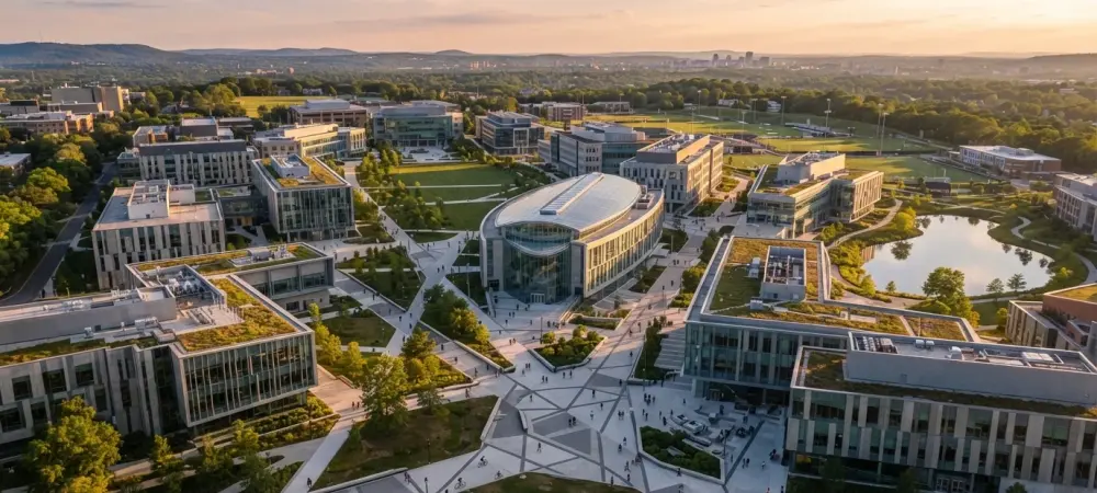
The inherent uncertainty of human travel is addressed through a maximum entropy model that recognizes students do not always choose the mathematically shortest path to their destinations. This realization sits at the heart of a pioneering study conducted at Southeast University’s Wuxi Campus, where researchers have harnessed the silent language of Wi-Fi signals to decode how individuals interact with their physical environment. In the sprawling, often disconnected landscapes of modern suburban universities, understanding the fluid movement of thousands of students and faculty members has traditionally been a matter of educated guesswork. By applying sophisticated artificial intelligence to the digital footprints left by mobile devices, the research team has successfully bridged the gap between architectural theory and lived experience. This methodology provides a transparent, data-driven window into the specific features—whether social, functional, or aesthetic—that truly define the value of a space to its inhabitants. As institutions increasingly look to optimize limited resources, this technology-driven approach offers a replicable blueprint for transforming static blueprints into dynamic, responsive environments that prioritize the human element.
Modern Planning Challenges and the AI Solution
Addressing the Limitations of Traditional Design: Moving Beyond Observation
Modern university campuses have evolved into sophisticated micro-cities, often situated in suburban peripheries where every walkway, courtyard, and hall must serve a specific functional purpose. In these self-contained environments, the quality of spatial design directly influences everything from student mental health to research productivity. Historically, urban planners and university administrators have relied on a mixture of spatial topology, rule-based flow simulations, and manual observations to decide where to place a new cafeteria or how to route a major thoroughfare. These methods, while foundational, frequently fail to capture the nuanced and goal-oriented nature of human behavior. For instance, a student might bypass a beautifully landscaped path simply because it feels isolated or lacks a convenient seating area nearby. By moving away from these rigid, top-down models, the research at Southeast University allows for a more organic understanding of how space is actually consumed, rather than how it was intended to be used. This paradigm shift acknowledges that a campus is a living organism, shaped by the collective decisions of its users. To overcome the pitfalls of traditional observation, the researchers turned to Inverse Reinforcement Learning (IRL), a machine learning technique that offers a unique perspective on pedestrian flow. Instead of requiring a human to pre-define what makes a location “attractive” or “efficient,” the IRL framework operates in reverse. It begins by observing the actual trajectories of individuals moving through the campus and then “works backward” to infer the underlying reward structure of the environment. Each destination, whether it is the library, a quiet study nook, or a busy transit hub, is viewed as a source of “reward” that pulls people toward it. This approach is particularly powerful because it can identify subtle environmental factors—such as the presence of street furniture or the proximity to green space—that might be overlooked by standard analysis. By treating every movement as a purposeful choice based on hidden motivations, the model provides planners with an objective measure of spatial value. This allows for a much more precise intervention strategy, where designers can enhance specific features that are already proven to be attractive to the campus population.
The Wi-Fi Probe Data Pipeline: Capturing Reality at Scale
The integrity of any AI-driven model is only as strong as the data that fuels it, and the Southeast University study utilized a massive repository of Wi-Fi probe records to ensure high-fidelity results. Over a two-week period, the team deployed 19 specialized Wi-Fi monitoring devices at strategic locations throughout the Wuxi Campus, focusing on major intersections and public gathering spots. These devices acted as non-intrusive observers, capturing the unique identifiers of smartphones, tablets, and laptops as they entered a 50-meter detection radius. The scale of this operation was immense, yielding approximately 3.26 million raw records that provided a comprehensive snapshot of campus life. This method of data collection is far more efficient than manual surveys or GPS tracking, which often suffer from small sample sizes or privacy concerns. By leveraging the existing infrastructure of mobile connectivity, the researchers were able to observe the natural ebb and flow of the student body without disrupting their daily routines. This provided an authentic dataset that captured the reality of campus navigation across different times of day and various weather conditions.
However, raw Wi-Fi probe data is notoriously difficult to work with because it is filled with “noise” and anomalies that can distort the final analysis. One major challenge involves signals from stationary hardware, such as surveillance cameras, printers, and smart appliances, which can be mistaken for human movement if not properly filtered. Additionally, the data often contains “jump records,” where a device’s signal oscillates rapidly between two overlapping probes, creating the illusion of impossible physical speed. To address these issues, the research team developed a rigorous, multi-stage cleaning pipeline that utilized advanced statistical techniques and signal processing. They implemented a sliding window approach to detect cyclic switching sequences and established specific thresholds for distance and speed to weed out unrealistic data points. This meticulous preparation was essential for transforming a chaotic mountain of pings into a structured dataset that could be used for behavioral mapping. By focusing on the purity of the data, the researchers ensured that the AI would learn from actual human decisions rather than technical artifacts or environmental background noise.
Refining Data for Machine Learning: Building the Trajectory Ground Truth
After the initial cleaning of the massive Wi-Fi dataset, the researchers utilized a Random Forest model to perform a final, sophisticated layer of anomaly detection. This supervised learning approach was specifically designed to identify and remove the most stubborn 10 percent of residual errors that simple threshold filtering might miss. By training the model to recognize the characteristic signal patterns of various device types and movement behaviors, the team could distinguish between a student walking to class and a background signal from a smart device left in a dormitory. This level of refinement is what sets this study apart from previous attempts at urban flow analysis. It moved beyond simple headcounts and started looking at the “intent” behind the signal. The result was a highly curated collection of 2,306 valid trajectories, representing over 260,000 individual behavioral records. These trajectories provided the granular detail necessary to understand not just where people were going, but the specific routes they chose to get there. This high-quality data served as the definitive ground truth for the subsequent machine learning iterations, ensuring the AI was grounded in reality.
The final step in preparing the data involved breaking these long trajectories into shorter sub-trajectories, averaging about 300 meters in length. This decision was based on the understanding that human goals are dynamic and can shift several times during a single trip across campus. For instance, a student might leave a dormitory with the primary goal of reaching the library but decide to stop at a café along the way. By analyzing these smaller segments, the AI could more accurately identify the specific environmental “rewards” that influenced choices at different stages of a journey. This granular approach allowed the model to capture the micro-decisions that define the pedestrian experience, such as choosing a path with more shade or a route that passes by a popular social hub. This level of detail is critical for spatial optimization, as it allows planners to see exactly where a path loses its appeal or where a small modification could significantly improve the flow of people. The refined dataset effectively turned the campus into a digital laboratory where every step taken by a student contributed to a deeper understanding of institutional design.
Methodology and Environmental Mapping
Discretizing the Campus Environment: Creating a Digital Twin
To translate the physical complexity of the Wuxi Campus into a format that an AI could analyze, the researchers employed a process known as spatial discretization. This involved overlaying the campus map with a grid, ultimately settling on a 35-by-40 resolution after testing various options. This grid served as a digital canvas where every cell represented a specific physical location with its own set of environmental characteristics. The team identified and mapped 41 distinct environmental elements across the campus, including functional buildings, green spaces, street facilities, and landscape features. By converting the physical world into a structured grid, the researchers created a “digital twin” that allowed the machine learning model to simulate pedestrian movement with high precision. This discretization was not merely about geography; it was about quantifying the “feel” of the campus, ensuring that the AI understood the difference between a busy administrative corridor and a secluded garden path. This step provided the necessary structure for the model to begin calculating the relationships between physical features and human behavior.
A crucial innovation in this mapping process was the use of a distance-based diffusion mechanism to account for the influence of specific buildings and facilities. The researchers recognized that a library’s attractiveness does not stop abruptly at its entrance; rather, it exerts a “pull” that extends into the surrounding walkways and courtyards. To model this, they calculated how the influence of each of the 41 environmental elements faded as a person moved further away along walkable paths. This technique ensures that the AI views the campus as a continuous field of overlapping influences rather than a collection of isolated points. For example, a cafeteria might have a strong influence within 50 meters, which gradually tapers off as the distance increases. This sophisticated approach allowed the model to understand the contextual value of every square meter of the campus. It acknowledged that the desirability of a path is determined by the sum of all nearby rewards, providing a much more realistic simulation of how students actually perceive and navigate their environment during their daily commutes.
Maximum Entropy Inverse Reinforcement Learning: Modeling Human Uncertainty
At the core of the study is the Maximum Entropy Inverse Reinforcement Learning (MaxEnt IRL) model, which was chosen for its unique ability to handle the inherent randomness of human behavior. Traditional reinforcement learning often assumes that an agent will always take the most efficient path to a goal, but humans are rarely that predictable. Students might take a longer route to walk with a friend, enjoy a particular view, or simply out of habit. The maximum entropy approach accounts for this by assuming that while people are generally goal-oriented, they also make sub-optimal choices. The model uses a deep neural network with seven fully connected layers to map the complex relationships between the 41 environmental features and the “reward value” of a given location. Through 1,137 training iterations, the AI adjusted its internal parameters until its simulated “agents” moved in a way that almost perfectly mirrored the trajectories recorded by the Wi-Fi probes. This resulted in a model that does not just predict the most likely path, but understands the distribution of all possible paths a student might take.
The use of maximum entropy is particularly important for urban planning because it prevents the model from being “over-fitted” to a single, perfect solution. Instead, it captures the diverse range of motivations that drive a campus population. By allowing for a certain degree of “stochasticity” or randomness, the AI can more accurately simulate how a change in the environment—such as adding a new seating area—might influence a variety of different users. The seven-layer neural network provides the computational depth needed to identify non-linear relationships between spatial features that a human observer might never notice. For instance, the model might discover that the combination of a water feature and a nearby transit stop creates a much higher reward than either feature would on its own. This ability to decode the “hidden logic” of the campus environment is what makes MaxEnt IRL such a powerful tool for architects. It transforms the planning process from a series of subjective decisions into a scientific exploration of human preference and spatial utility.
Key Findings on Campus Attractiveness: Visualizing the Hidden Pulse
The output of the trained AI model provided a detailed “heat map” of rewards that visually represented the most and least attractive areas of the Wuxi Campus. Not surprisingly, the highest reward values were concentrated around the primary hubs of student life, including the library, the main cafeteria, and the dormitory clusters. These findings validated the model’s accuracy, as these locations are the undeniable centers of activity. However, the AI also highlighted significant “dead zones”—areas that, despite being centrally located or well-maintained, offered very little reward to the users. One notable example was a small garden area situated between the Boya Building and the South High Courtyard, which the model identified as having exceptionally low vitality. Real-world observations confirmed that students rarely lingered in this space, suggesting a disconnect between its intended design and its actual utility. This insight allows planners to pinpoint exactly which areas are failing to meet their potential and require creative intervention to become functional parts of the campus fabric.
Beyond identifying functional anchors, the study revealed fascinating demographic and regional disparities in spatial attractiveness. For example, the model showed that the northern clusters of study spaces were significantly more attractive than their southern counterparts, likely due to a higher density of diverse facilities and better connectivity. Even more striking was the difference in reward values between physically similar dormitory buildings; the female dormitory scored lower in overall attractiveness compared to the male dormitory, a finding the researchers attributed to the campus’s heavy engineering focus and predominantly male population. This suggests that the environment itself may not be equally welcoming or useful to all segments of the student body. These kinds of insights are invaluable for creating more inclusive and equitable campus designs. By uncovering these hidden patterns, the AI provides a factual basis for discussions about how to better serve diverse student needs. It moves the conversation beyond aesthetics and into the realm of social and functional equity, ensuring that every student has access to high-reward spaces.
Practical Applications and Future Design
Testing Robustness and Scalability: Adapting the AI for Any Campus
A major concern when implementing complex AI models in urban planning is how well they can scale and whether they remain accurate under different conditions. To address this, the researchers conducted an extensive sensitivity analysis by testing the framework across three different grid resolutions. They compared a coarse 18-by-20 grid, the standard 35-by-40 grid, and a high-detail 70-by-80 grid. While the finest resolution offered the most granular insights, it also required significantly more computational time—over nine hours on a high-end workstation. However, the most important finding was that the overall structure of spatial rewards and the ranking of attractive zones remained remarkably stable regardless of the grid size. This suggests that the IRL framework is highly robust and can be adapted to fit the specific needs and resources of different planning departments. A smaller college with limited computing power could still gain meaningful insights using a coarser grid, while a large research university could invest in high-resolution modeling for specific, high-stakes development projects.
This scalability makes the technology a versatile tool for a wide range of institutional environments, from small liberal arts colleges to massive urban university systems. The robustness of the model also implies that it can handle varying levels of data quality. While the Southeast University study benefited from a massive Wi-Fi dataset, the framework’s ability to maintain its findings across different resolutions suggests it could still provide value even with fewer monitoring devices. This is a critical consideration for administrators who may be hesitant to invest in extensive sensor networks. The study demonstrates that the methodology is not a “black box” that only works under perfect conditions, but a flexible system that can be tuned to provide the best possible insights given the available data. By proving the model’s stability, the researchers have created a tool that is ready for real-world application in a variety of geographical and institutional contexts, paving the way for a more widespread adoption of AI in the field of campus management.
Optimizing Underutilized Spaces: The Zhongshan Courtyard Intervention
The true test of any planning tool is its ability to solve real-world problems, and the researchers applied their model to a specific challenge: the low vitality of the Zhongshan Courtyard. This first-floor lobby café was centrally located but consistently struggled to attract visitors. By feeding hypothetical “what-if” scenarios into the trained AI model, the team was able to simulate the impact of various design and policy changes before any physical work began. They proposed two main strategies: increasing the density of workstations within the courtyard to match the popular northern study hubs and redistributing certain administrative functions to create a “forced” flow of pedestrians through the space. The model predicted that these changes would lead to a significant increase in both the reward value and the actual traffic in the courtyard. This capability to test renovations in a virtual environment is a game-changer for university budgeting, as it allows institutions to invest their limited capital only in projects with a high probability of success.
This predictive power transforms the role of the urban planner from a designer of static spaces to a manager of dynamic flows. Instead of relying on a “build it and they will come” philosophy, administrators can use AI to verify that a proposed change will actually result in the desired behavioral outcome. In the case of the Zhongshan Courtyard, the model showed that the lack of vitality wasn’t necessarily due to the café itself, but rather to the surrounding spatial logic and the distribution of functional “rewards.” By addressing these underlying issues, the university could breathe new life into an underused asset. This approach can be applied to any number of campus issues, from optimizing the layout of a new student center to improving the safety and accessibility of nighttime walking paths. The ability to simulate the human response to architectural change provides a level of certainty that was previously impossible, ensuring that campus renovations are both effective and efficient.
The Future of Smart Campus Development: A Data-Driven Blueprint
The Southeast University study established a new standard for the integration of behavioral science and artificial intelligence in campus planning. By moving away from top-down assumptions, the methodology allowed for a bottom-up understanding of student motivation that was previously inaccessible to designers. The research proved that anonymous Wi-Fi signals could serve as a powerful lens through which to view the hidden pulse of a community. Planners were then able to act as curators of data-driven insights rather than architects of assumptions, ensuring that every modification to the campus environment served a demonstrated need. The successful simulation of the Zhongshan Courtyard improvements provided a clear path forward for how universities could test spatial theories before committing to physical construction. This transition toward a smarter, more responsive design process promised to create environments that were not only more efficient but also more aligned with the well-being of the people who used them every day.
Moving forward, the implementation of this framework offered a way to continuously monitor and improve the campus experience as student needs changed over time. The researchers suggested that long-term data collection could capture seasonal shifts in behavior, such as how students used outdoor spaces differently in the spring versus the winter. This ongoing feedback loop would allow for a “living campus” that evolved in real-time. Furthermore, the principles developed in this study were not limited to academic settings; they could be applied to corporate headquarters, hospital complexes, or even entire urban neighborhoods. By treating every Wi-Fi signal as a vote for a specific spatial feature, planners could build cities that were truly designed by the people, for the people. The technology turned the invisible threads of connectivity into a roadmap for a better-designed world, where the built environment and human desire existed in perfect harmony. Future iterations of this work will likely integrate even more data sources, such as environmental sensors or academic schedules, to provide an even more holistic view of the urban experience.